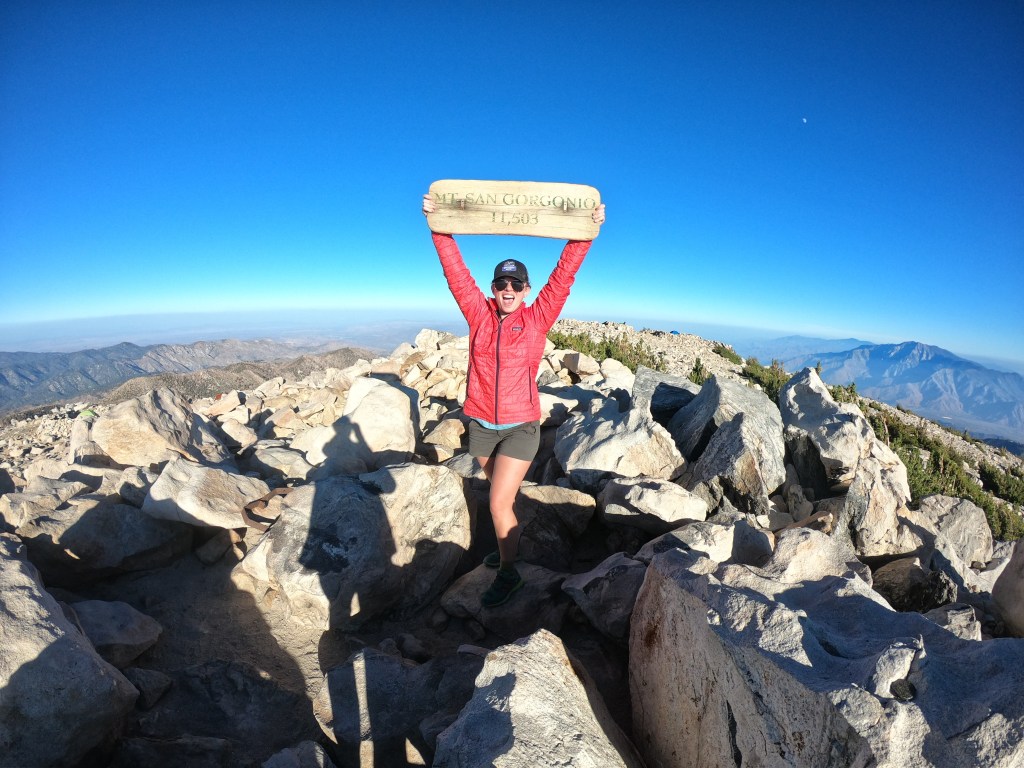
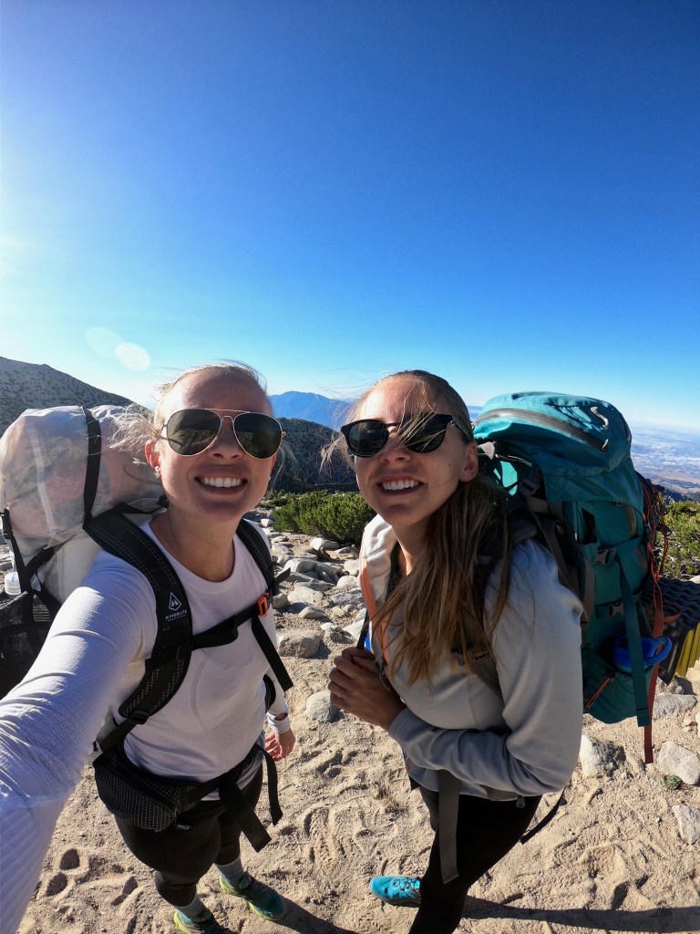
On the first weekend in September, my bestie and I hiked San Gorgonio and spent the night on the summit as part of our (now two-year) plan to hike the Socal Six Pack of Peaks. San Gorgonio is the highest peak in Southern California, topping out at 11,503 feet. On a clear day, you have expansive 360-degree views of the Pacific Ocean, Mojave Desert, and even out to the Eastern Sierras.
Although there are multiple trails that you could take to summit San Gorgonio, we chose to take the Vivian Creek Trail. The Vivian Creek Trail is probably the most popular of the trails leading to San Gorgonio. Although it may be steep in elevation gain (5,492 feet up!), it is the shortest of the trails, coming in at a hefty 8.8 miles one way. Because of the length and elevation gain, we chose to do Gorgonio as a one-night backpacking trip (and my bestie’s first backpacking trip EVER – you go girl).
For one of the most famous peaks in Southern California, I had the HARDEST TIME finding out any information about the area and my upcoming hike. I found the permit system very outdated and difficult to navigate, and had trouble understanding which camps were located on the Vivian Creek Trailhead.
Below you will find my comprehensive guide to backpacking San Gorgonio. I included all of the information that I wish I had when I started my hike. If you have any questions about the trail, comment below or email me at meghikes1@gmail.com!
Quick Stats
Mileage: 17.6 miles roundtrip
Elevation Gain: 5,492 ft.
Starting Elevation: 6,011 ft.
Ending Elevation: 11,503 ft.
Difficulty: Strenuous
When To Go: June – October (depending on the snow level)
Location
San Gorgonio is located 82 miles east of Los Angeles, just south of Big Bear. From the 10 freeway (coming east or west), you’ll take Highway 38 through Forest Falls to get to the trailhead.

For driving directions, the trailhead address is:
Vivian Creek Trailhead
41900 Falls Rd.
Forest Falls, CA 92339
Permits
Adventure Pass: To park at the Vivian Creek trailhead, you need to display an Adventure Pass. Passes are not available for purchase at the trailhead, so plan accordingly! Here is a list of all of the places that you can purchase an Adventure Pass.
Day trips: Permits are not required for day hikes, but are “strongly encouraged” by the San Gorgonio Wilderness Association – basically just to ensure that the Forest Service knows that you are out there in case of an emergency.
Overnight trips: Permits are required by the San Gorgonio Wilderness Association for all overnight trips to the area. You acquire permits by filling out a physical request form and emailing, faxing, or physically mailing it to SGWA. If approved, SGWA will send you back your permit form with an approval stamp on the bottom.
Permit requests are accepted starting 90 days in advance. If you are planning on going in the summer months (during the peak period), apply as soon as possible.
Be sure to keep an eye on your email after you send in your permit request. We initially applied by email for a weekend in August, but we never received any sort of permit approval, rejection, or even confirmation that our permit was received. About two weeks later, we reapplied for a weekend in September, immediately received confirmation that our permit request was received, and a day later, received confirmation that it was approved. I’m not entirely sure why the first permit request did not work – maybe it was because the weekend was already full or maybe it was because under “vehicle remarks,” I wrote “damn sexy car” – who is really to say?
Once you receive your permit, I would highly suggest printing out your approved permit form and bringing it with you on your hike. We ran into one ranger who checked our permits while we were taking a lunch break. When I fished out my printed permit from my backpack, the ranger made a point to thank us for printing it out and mentioned that he has to send people back who try to bring it up on their phone and don’t have enough service to do so.
Find instructions for the permit approval form on this website.
Find the actual permit request form here.
Do not find the permit request for on this website. It seriously took me FOR-EV-ER to realize that this was not the permit request page. SGWA, please update your website. It kind of blows.
Backcountry Camps
There are four different places that you can camp along the Vivian Creek Trail: Vivian Creek Camp, Halfway Camp, High Creek Camp, and Summit Camp.
| CAMP | MILEAGE FROM TRAILHEAD | ELEVATION | WATER |
| Vivian Creek Camp | 1.2 miles | 7100 ft. | Very likely |
| Halfway Camp | 2.5 miles | 8100 ft. | Likely |
| High Camp | 5.8 miles | 9200 ft. | Seasonally |
| Summit Camp | 8.8 miles | 11503 ft. | No |

Vivian Creek Camp is located 1.2 miles up the trail and is absolutely beautiful. The camp comes after a BRUTAL (arguably one of the hardest sections of the trail) climb up from Mill Creek Canyon. Funny story – as soon as we crested the “Mill Creek climb” and found ourselves at Vivian Creek camp, I turned around and told my friend, “Wow, this is actually kind of pretty,” as if I was surprised that nature could be so beautiful. That climb really took it out of me! The camp is off trail, and since we were in a rush to summit as early as possible, we didn’t stop to check it out. From the area though, it looked well-shaded and quite protected. The water was rushing when we summited in September, and I’ve heard that it is the most reliable water source on the trail. I would imagine that Vivian Creek Camp is probably the least popular of all the camps, if only because it is so close to the trailhead, but it looked like a great option!
Halfway Camp is located 2.5 miles up the trail and looked like the largest of the camps along the Vivian Creek Trail. The campground seemed to span over about a half a mile. There were plenty of flat, shaded sites with lots of room in between – when we were there, it was enough for an entire boy scout troop + accompanying dads to have their own little area away from the rest of the campers! If you are backpacking in the area with a large group, I would definitely recommend staying at Halfway Camp. I’ve also heard that the water source is pretty reliable year-round. (P.S. – don’t let the name fool you! Halfway Camp is definitely NOT halfway up the trail!)
High Camp is located 5.8 miles up the trail and seemed to be the most popular of the camps. It was located right under the brutal switchbacks up to the ridge before the summit, so it really would be the perfect stopping point to set yourself up for a summit the next day. The camp was also off-trail, so we couldn’t see how big it was, but from the area, I would assume that you’d be relatively on top of each other. The water was definitely the most seasonal of all of the camps, so if you go late in the season, be sure to call the ranger station and check to see if water is flowing.
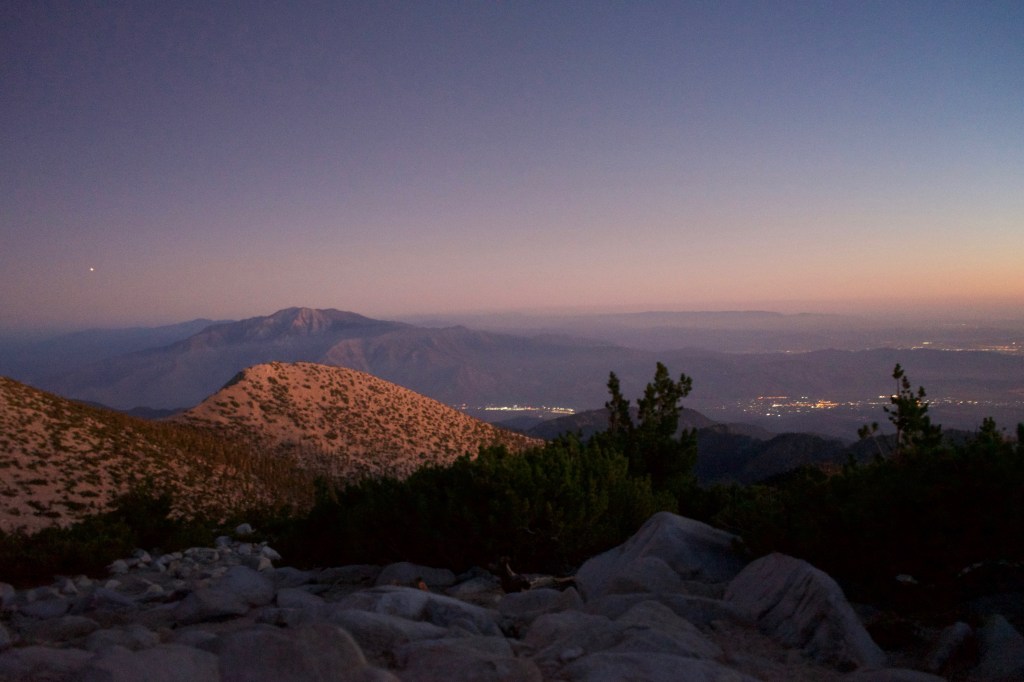
Summit Camp is located at the summit of San Gorgonio and offers, quite possibly, the best views of sunrise and sunset in all of Southern California! Because the summit is well-above the treeline, all of the camps are extremely exposed. There are rock walls that will (semi) protect from the wind, but you are definitely always exposed to the elements. The wind howled up to 50-60 mph on the night that we stayed, and there were a few too many times that I legit thought that our tent was going to collapse on itself. Fortunately, our tent held strong throughout the night (and surprisingly, our eyelids also held strong on the hike down after a grand total of ~2 hours of sleep). Despite the less-than-ideal weather, Summit Camp truly was breathtaking, and I was really glad that we chose to stay up there.
Keep in mind that all of the water access at each of the camps is completely natural, so to be on the safe side, I would peruse forums or call the Ranger Station prior to your hike to make sure that water is available where you would like to fill up.
The Hike
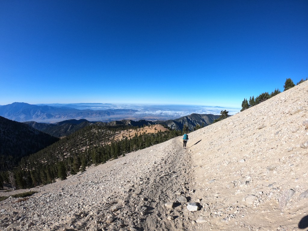
Spoiler alert, this hike is absolutely brutal. The elevation gain is absolutely relentless (you gain 5500 feet – that is over a vertical mile!). While there are the occasional switchbacks, much of this hike is STEEP and exposed. The altitude will have you huffing and puffing long before you reach the summit.
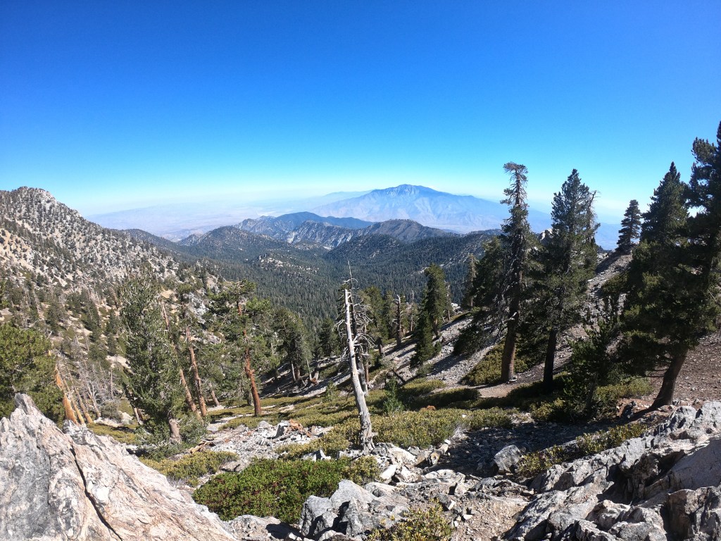
With that being said, the trail is absolutely beautiful and showcases California’s diverse landscape. You’ll start out in the high desert with the California oaks and, soon enough, end among weathered coniferous pines at the summit. On a clear day, you’ll be able to see all the way to Mt. Whitney (!), the Pacific Ocean, and the low, low desert. For as much pain as this trail provides, in the end, it is completely worth it.
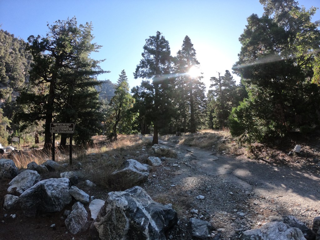
Your hike begins in Mill Creek Canyon, following the dry riverbed until the trail crosses it about a half a mile in. After crossing the riverbed, you begin your ascent.
The slog up Mill Creek Canyon is, to put in lightly, shocking. Within the first half mile of the hike, you are immediately on the steepest section of the trail, gaining 1,000 feet in a mile. Although the low elevation helps with the steepness of the trail, it also allows that section to get extremely hot. To top it off, this section has minimal tree cover to protect you from the sun. Best advice? Put your head down; remember that after a mile, you’ll be done with the steepest section; and take lots of breaks to knock it out.
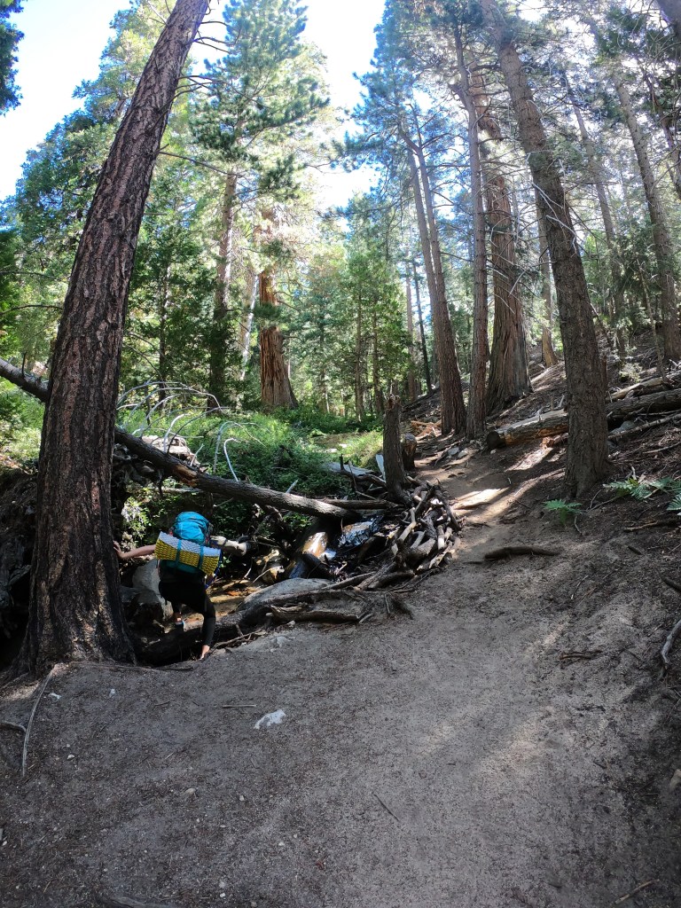
Eventually, you’ll reach the relief that is Vivian Creek. Hot, oak shrubbery is quickly replaced with a wet, coniferous forest. I couldn’t believe how quickly the environment changed – our spirits were instantly lifted and we were ready to knock out the next section! Vivian Creek is also the first water source on the trail, so fill up here if you are running low on water.
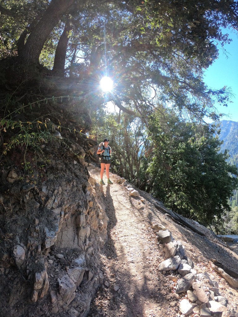
After following Vivian Creek for a sixth of a mile, the trail climbs away from the creek and starts making its way up towards Halfway Camp. A quick climb will reward you with great views of the Valley of the Falls and down towards the Inland Empire. You’ll gently switchback up the mountain until you arrive at Halfway Camp. Don’t let the name fool you though, you definitely aren’t halfway to the summit!

Leaving Halfway Camp, you’ll continue to climb gentle switchbacks among the pines. This section was extremely pleasant, and each turn offered a new view of the surrounding valleys. Finally, you’ll follow a ridge to the north where you will find High Camp. Fill up your water here, as it is the last water source on the trail.
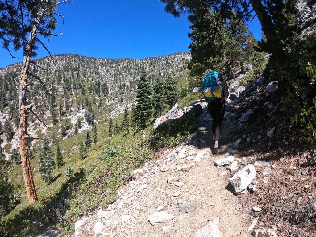
Take your time at High Camp, because it is the last section of reprieve before the summit. As soon as you leave High Camp, you immediately start ascending on long, grueling switchbacks. The switchbacks themselves aren’t necessarily super steep, but they are unnecessarily super long.
The switchbacks last about .7 miles until you crest the ridge and get an incredible view of San Jacinto. The trail then bends to the north, and once again you hit a section of gnarly steep switchbacks. Take your time here as well, because you’ll need to conserve your energy for the final push to the summit.
The final push takes form of a long, steep traverse to the summit. As you continue to the summit, you’ll find multiple junctions to the other trailheads leading up to the summit. After at least one (1) false summit, you’ll approach the summit! I ain’t gonna lie, the summit is a little underwhelming (think pile of rocks on top of a flat area), but you’ll relish in your success as soon as you realize just how high you climbed!

The climb up to San Gorgonio is long, but so so worth it. It is a rite of passage for any Southern California hiker, and it is the perfect training hike for some of the higher peaks in the Sierra. A wonderful hike all around! (Once you get back to the car, of course!).
Video Evidence That We Summited
Happy hiking! As always, if you have any questions, leave a comment below or email me at meghikes1@gmail.com.
