
On January 26, 2019, my friend, Jenny, and I hiked up from the closure on Whitney Portal Road to to the Portal! My Garmin registered our hike at 12.62 miles with 1831 feet in elevation gain, but I think a lot of those miles were us playing around in the snowshoes and getting off trail quite a bit. If you were to hike straight up to the Portal and back, I would guess that you’d probably tap out around 9.5 to 10 miles!
Our hike began around 8 am at the road closure on Whitey Portal Road. We had camped in the Alabama Hills the night before, and had woken up early to watch the sunrise! After photographing Whitney in the golden morning light, we drove up to the closure and parked at the big lot on the right side of the road.
A note about the road closure: Unless there was recently a significant storm, you probably will not encounter snow as low as the closure. The closure is located at an elevation of 6312 feet, which is pretty low for Sierra snow line. That being said, even though you may be tempted to drive up the road until you actually hit snow, I would recommend against it. Rumor has it that you can get ticketed if caught past the closure. Although it’s probably pretty rare that CHP would be up there ticketing people, we didn’t want to take that risk. Moreso than the danger of getting ticketed, in my opinion, would be the danger of all of the ice up there! Although the road was clear and dry when we started walking, it quickly began to get icy and did not thaw out that day. Whitney Portal Road is pretty skinny; I wouldn’t want to get caught on ice without a place to turn around – or to get caught slipping and sliding so close to the edge! That being said, we saw a few trucks pass us past the closure and were fine. To each their own, I suppose.
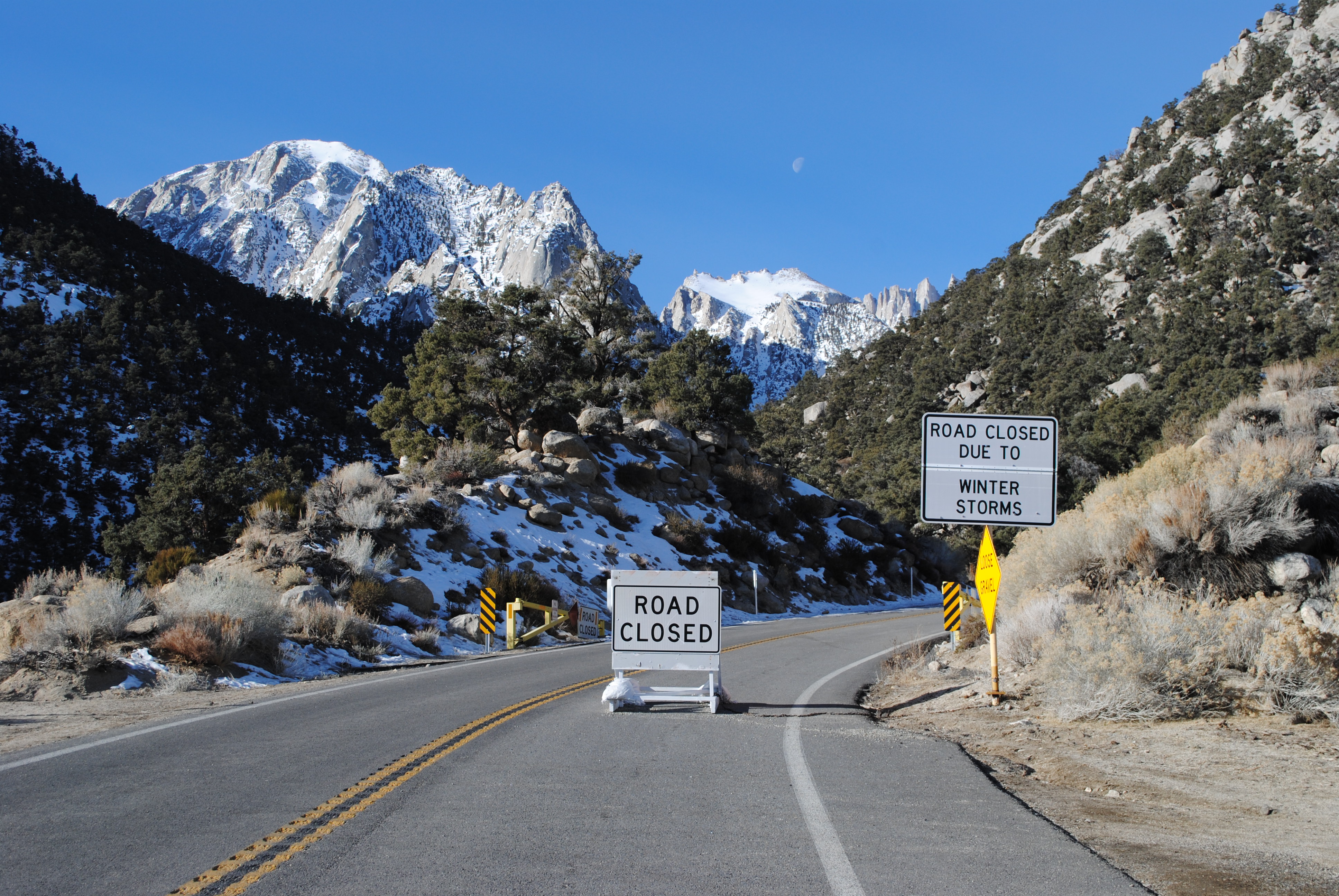
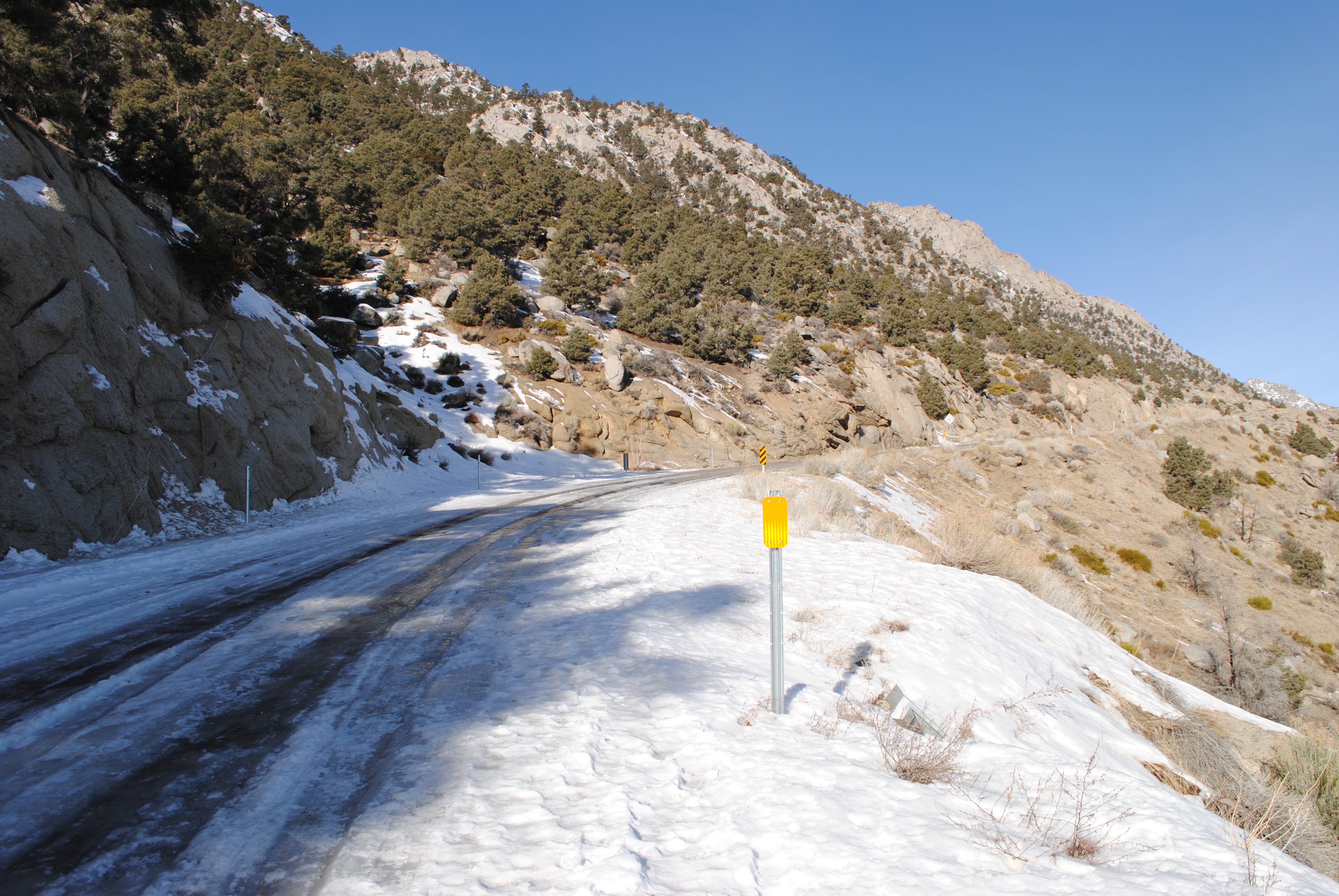
Although the closure itself was completely dry, almost immediately, you start hitting ice in the shady patches of road. It was pretty clear that, at one point, it was warm enough after the storm for the snow to start melting, because that shiz was SLICK. We didn’t want to have to keep putting on and taking off our microspikes, so we stuck to the side of the road where the snow was still crunchy so that we wouldn’t slip. Another reason not to drive up past the road closure…
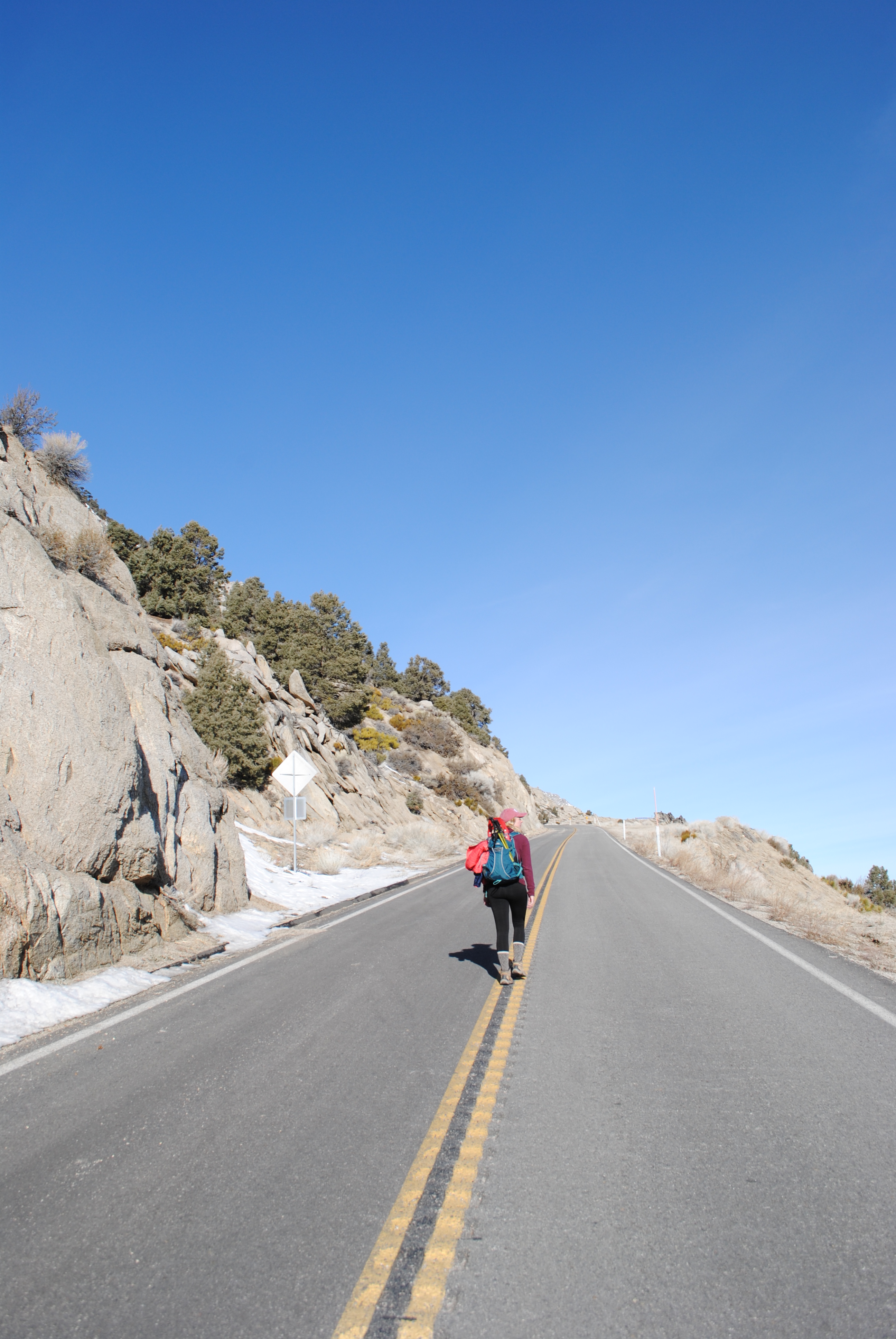
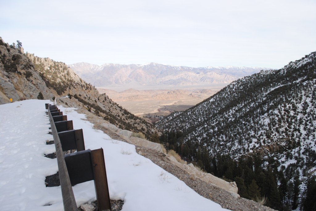
As far as road walks go, this one was a beaut! Now, road walks aren’t my least favorite thing in the world, but they sure aren’t my favorite either. Like many hikers I know, I’d prefer to go without. BUT! In terms of road walks, this one was actually pretty cool. I don’t think I’ve ever taken the time to appreciate the views from Whitney Portal Road. Every time I take it, I’m either speeding uphill towards the trailhead or speeding downhill towards cold beer. To be able to appreciate the views of the Sierra to one side and the Owens Valley to the other was pretty incredible, especially considering we were on foot!
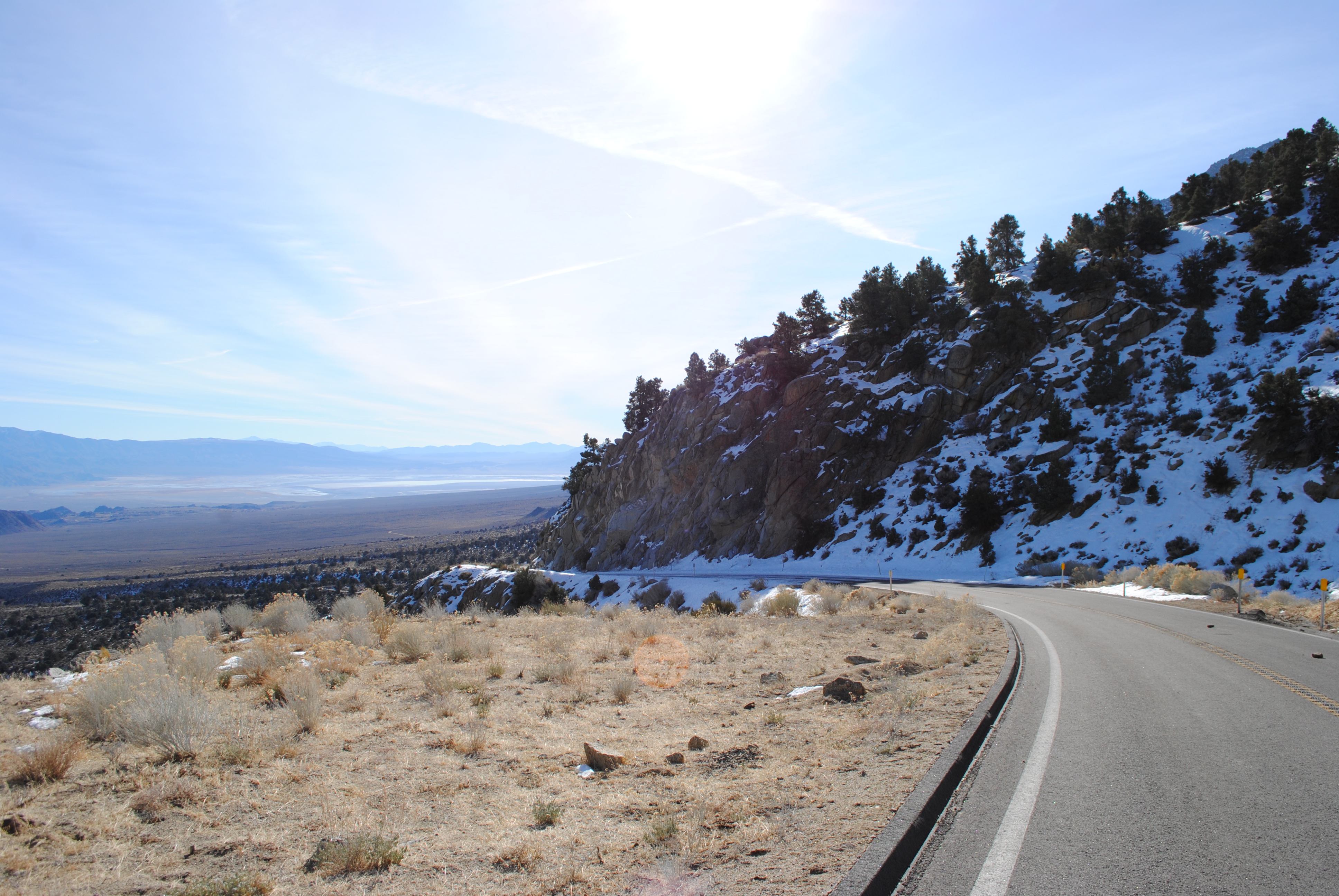
For those of you who aren’t familiar with Whitney Portal Road, immediately after the road closure are two long switchbacks traversing up the mountain, parallel to the Owens Valley, before the road straightens out and follows Lone Pine Creek up towards Whitney. The first switchback gave us an amazing view of the Owens Valley, for as far as the eye could see.

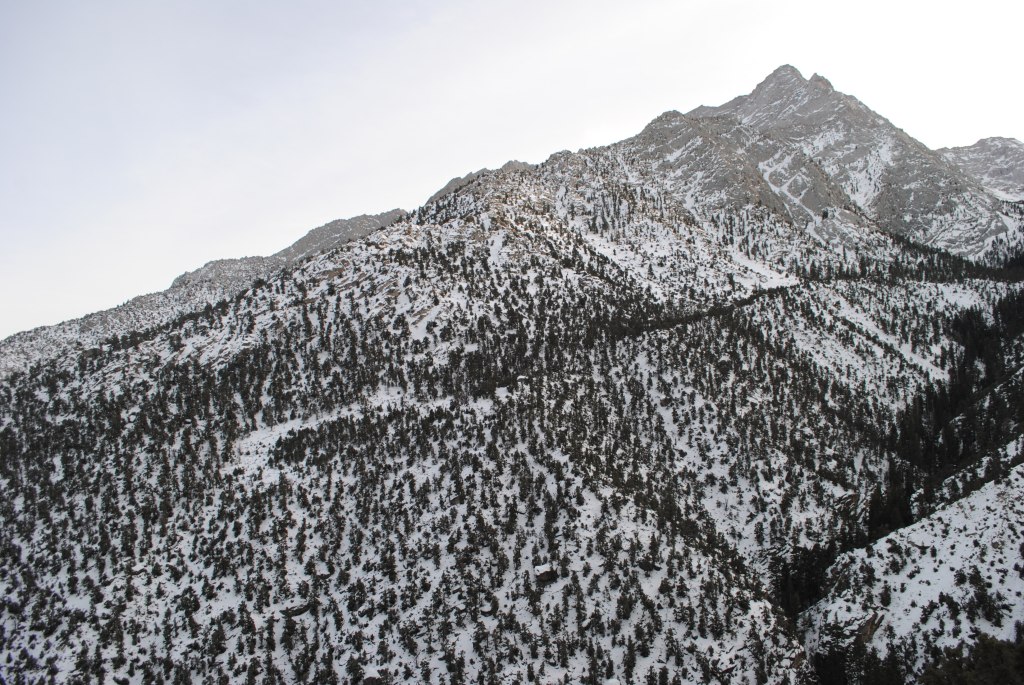
Around a ninth of mile from the road closure, you’ll hit the big u-turn in the road and begin up your second switchback. Heading south, you’ll begin to get expansive views of the Sierras rising above the desert floor. Soon, you’ll catch your first glimpse of Lone Pine Peak, standing tall at 12,949 feet.

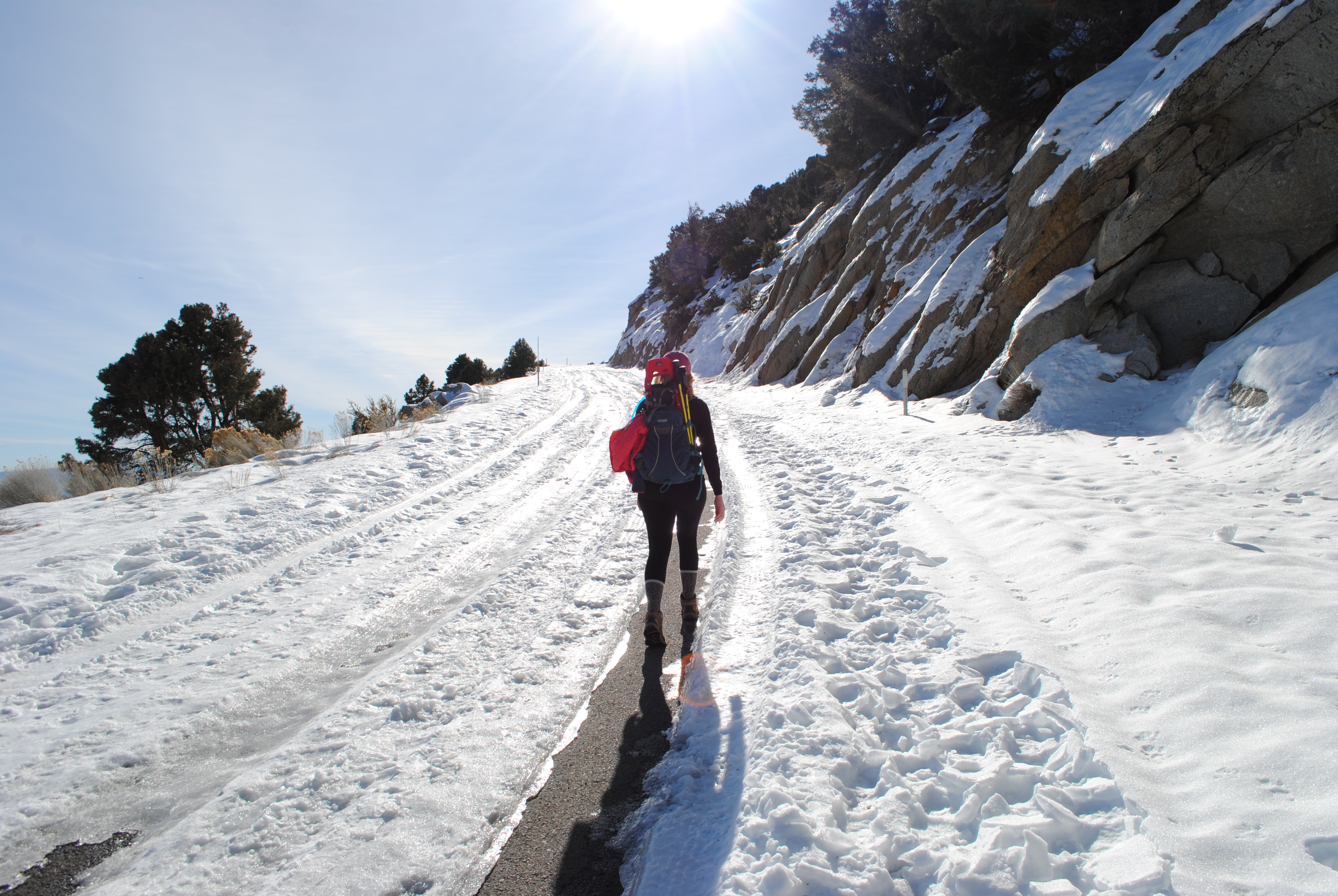
It was on this switchback that we encountered our first huge section of snow. It started out with some dry patches lining the road where tires had cleared the snow and ice away, but eventually, our dry asphalt turned into pure ice. We made the decision to put on microspikes at this point, and I’m glad we did! You’ll soon encounter another large dry section of the road, so we took our microspikes back off at that point, but the snow section was long enough to warrant the time to quickly put them on.

Once you round the curve in the road at the top of the second switchback, Lone Pine Peak really comes into view, and you are treated, once again, to a view that you don’t often see from your speeding car: Lone Pine Peak on the left and (what I believe to be) Mt. Irvine on the right. Can anyone confirm that this is indeed Mt. Irvine?

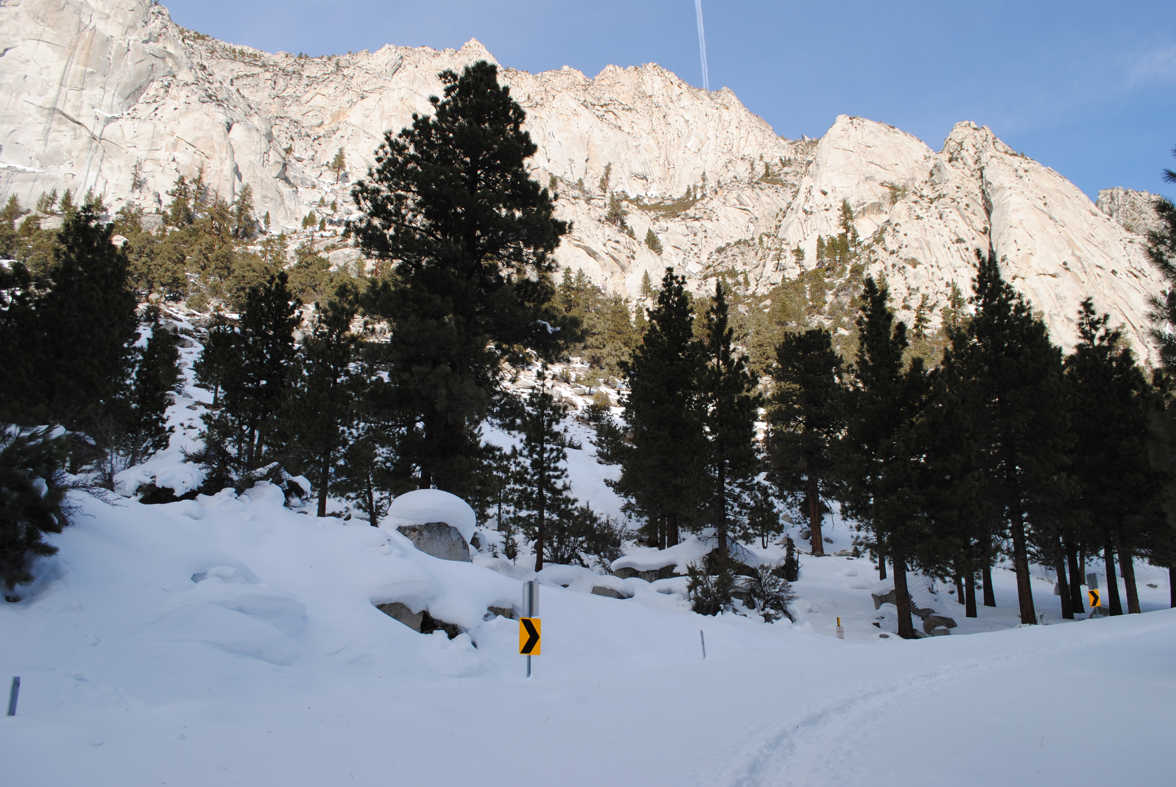
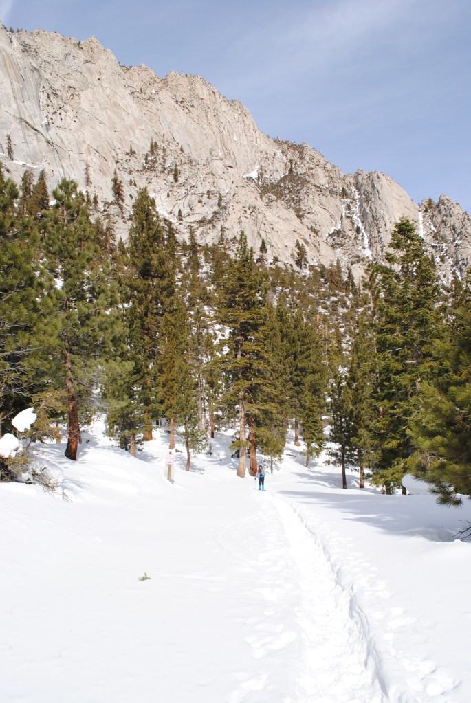
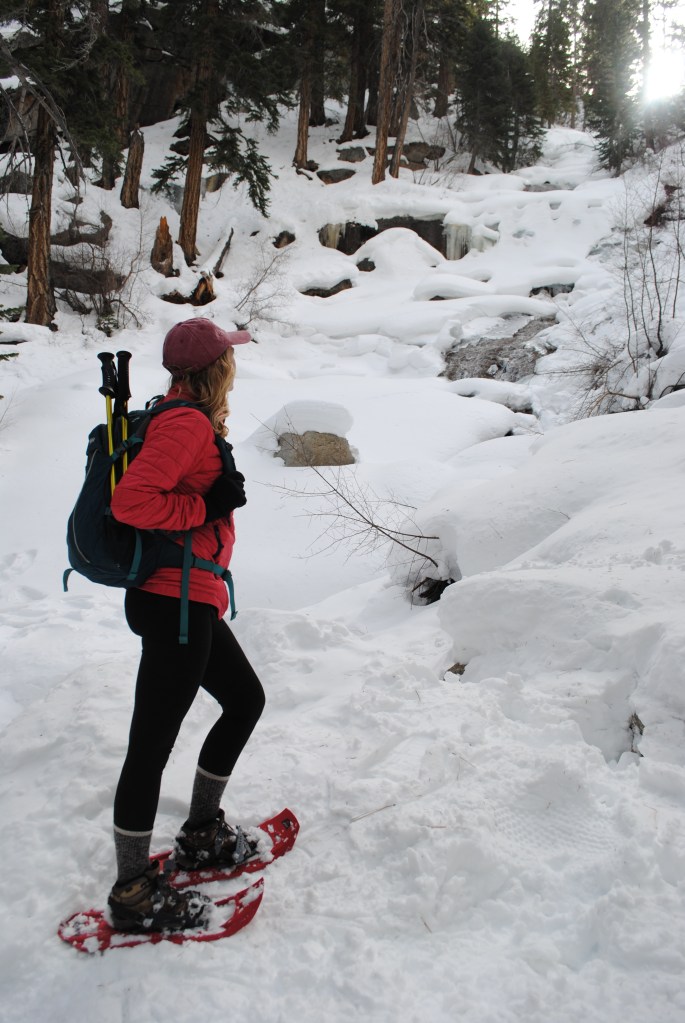
After a few quick s-turns, you take one more corner, and BAM! You are treated to the first up-close and personal view of Mt. Whitney herself. It was here in which the snow became (almost instantaneously) pretty deep. We put on our microspikes once again and did not take them off! Once you see Mt. Whitney for the first time, the road continues along Lone Pine Creek towards the summit.

Eventually, we entered the shadow of Lone Pine Peak and the temp DROPPED. It was here that we started postholing quite a bit, so we ended up putting on our snowshoes. You could have gotten by without them, but we found them to be more of a help than a hindrance (as premature snowshoeing tends to be)!

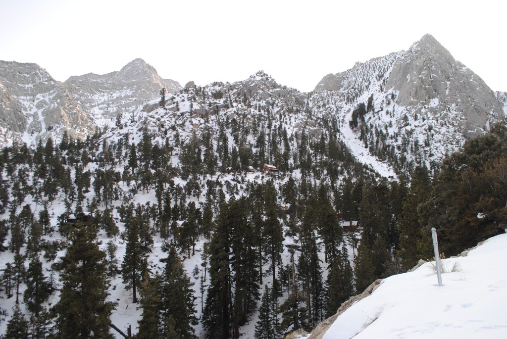
From here, there is only one more big s-turn in the road before you get up to the Portal. You’ll start seeing sings of the Portal quickly; the trailhead to Meysan Lakes, the group campground, and signs for the Portal itself.
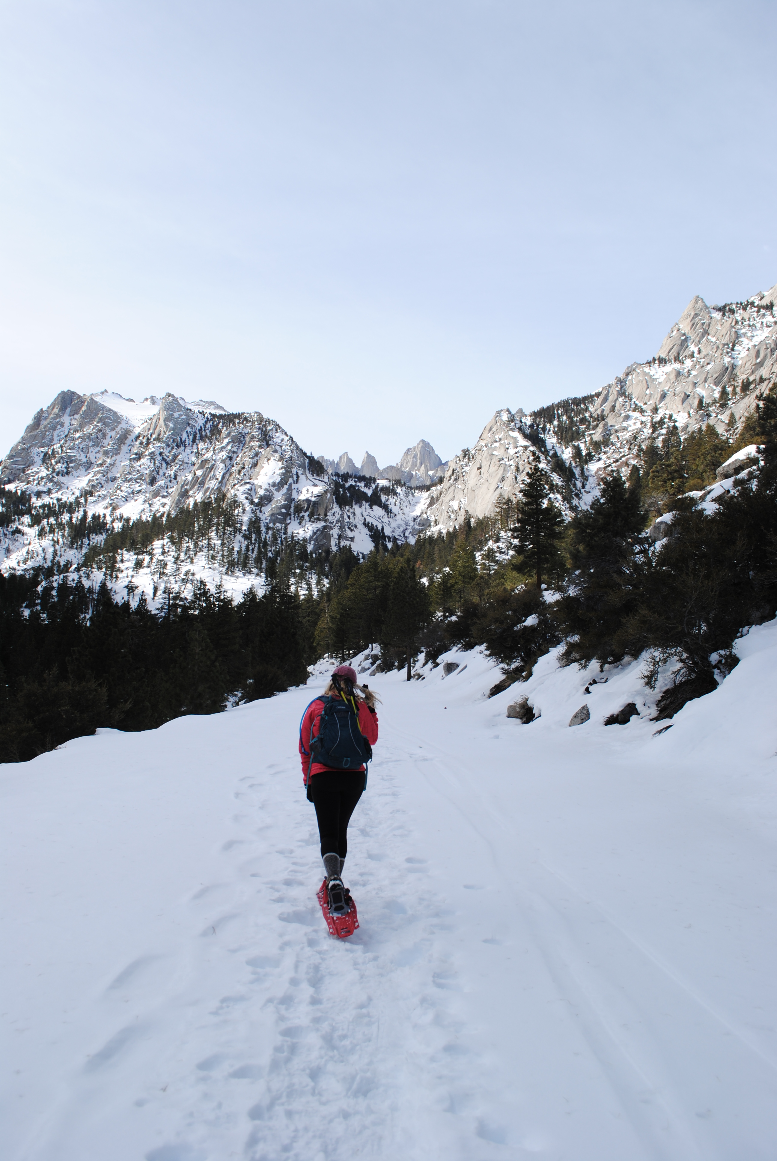
Because our “trail” was the road, it never got too steep. It stayed extremely gradual, which made for a perfect day! We were able to focus on the peaks and views ahead instead of worrying about the condition or steepness of the trail.
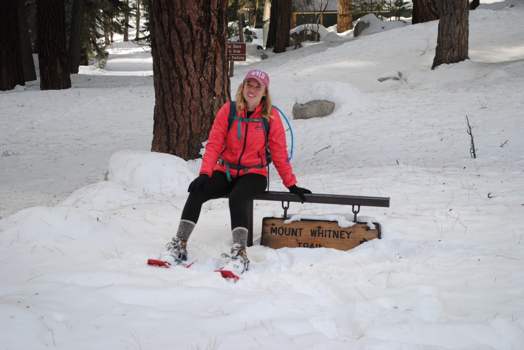
Once we got to the Portal, there was so much snow! The Mt. Whitney trailhead sign was almost buried.. and I’m convinced that with the MASSIVE amount of snow that the Eastern Sierra received in the first 10 days of February, it is probably buried by the time that I write this!

We moseyed up the trail to Whitney a little bit, and were surprised to see a solid, packed-down trail! I don’t know how far the trail goes up, but we saw two sets of backpackers on the trail who told us they were aiming for Lone Pine Lake. I’d be surprised if the broken trail did not lead up to the lake at least. But who knows – it might also have lead up the Mountaineer’s Route of Whitney. Anyone been up there recently and know where it goes?
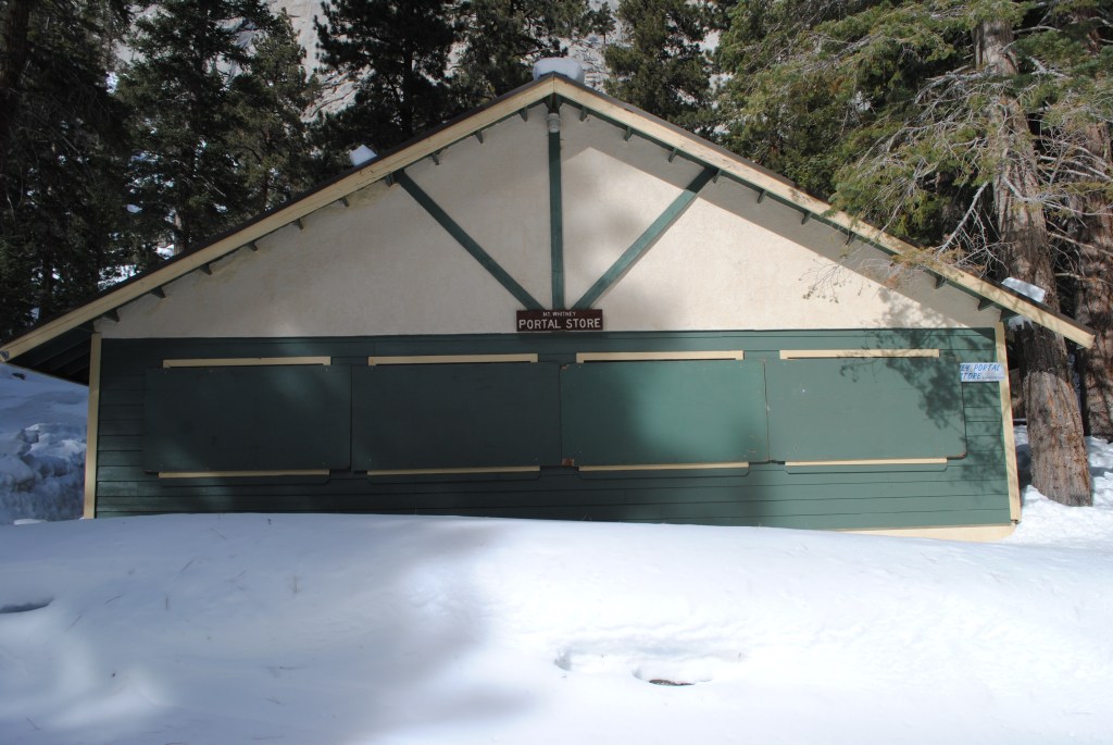
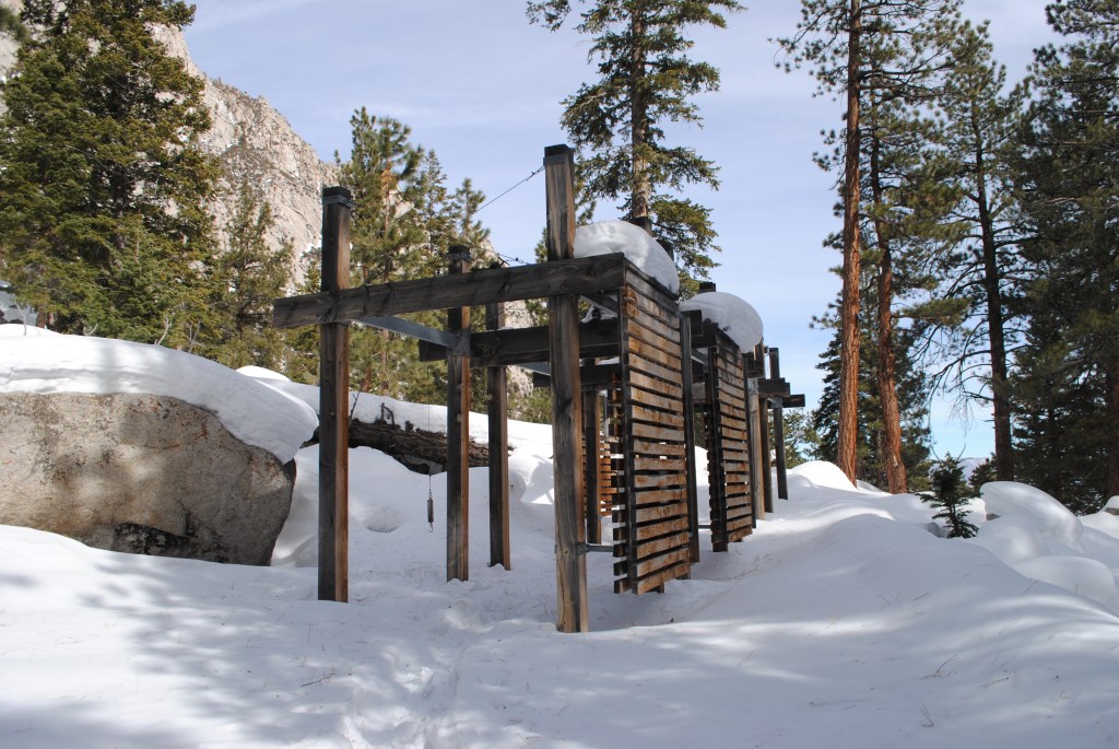
The Portal looked so beautiful covered in a blanket of snow! You could see traces of summer in the picnic tables peaking out of the powder, the mounds of snow covering the bear boxes, and the boarded up Portal Store. I have to admit though, as much as I LOVED experiencing it in winter, it made me that much more excited for summer adventures.
We ventured to the waterfall at the far end of the Portal and it was (almost) frozen over! Lots of beautiful icicles and snow bridges – it was so cool to see and hear the creek run underneath all that snow. If you make it up to the Portal, I would highly recommend checking out the waterfall!
After exploring the Portal for a couple of hours, we decided to head back down. We crossed paths with a few backpackers, as well as a group that was heading up to one of the summer homes!! My jealousy was through the roof. Anyone know if any of these cabins are for sale? (only half kidding. seriously, if you know of a cabin for sale, hit me up.)
The soft evening light on Lone Pine Peak was absolutely breathtaking. It’s no wonder this area is known as the Range of Light. This pastel sunset was a stark contrast from the bight gold sunrise that we had witnessed just hours earlier. I’m full convinced that there are no bad sunsets in the Sierra!
The end of our hike consisted of a long road walk back down to our cars. Just like the road walk up, it wasn’t so bad with views of the sunset light on the Owens Valley! We had an amazing day exploring the Portal on snowshoes, and I can’t wait to go back to continue on to Lone Pine Lake one day!
Heading up to the Portal any time soon and have questions about your trip? Leave a comment below or email me at meghikes1@gmail.com. Happy Trails!
